Home
General Information
What is the Downtown Relief Line?
FAQ
Information for Drivers
How You Can Help
Political Support
About Me
Acknowledgments
Contact
Why Build The Line?
Yonge Capacity Issues
Queen/King Streetcar Issues
Transit City
Better Transit to Underserved Neighbourhoods
A Faster Trip Downtown
Logical Expansion
Subway Benefits
Route Information
History of the Line
Route Determination
Ridership Analysis
Cost Analysis
Obstacles to Construction
Google Map
Station Information
Interactive Map
First Stage
Second Stage
Third Stage
Fourth Stage
Academic Information
Methodology
References
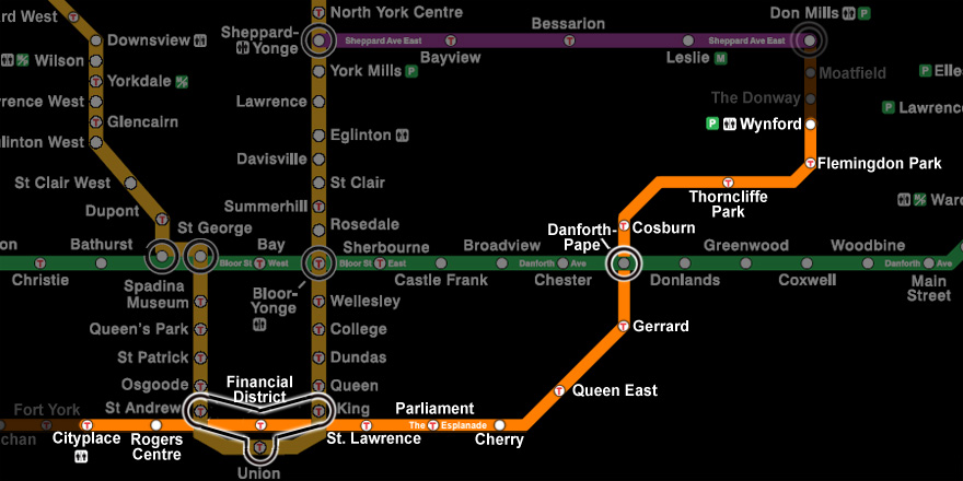
First Stage of Construction
Print This Page
Cityplace
•
Rogers Centre
•
Financial District
•
St. Lawrence
•
Parliament
•
Cherry
•
Queen East
•
Gerrard
•
Danforth - Pape
•
Cosburn
•
Thorncliffe Park
•
Flemingdon Park
•
Wynford
© 2010 Phil Orr & Andrew Perry